S
640 x 480 px
FREE
M
1920 x 1440 px
FREE
L
4032 x 3024 px
FREE
Upgrade to download up to 10 images at a time.
Standard license
This Takamatsu city area (with Yashima fog) photo can be used for personal projects. It can also be used for commercial projects in some cases. Read more
Image information
المنشئ:スターゲイザー☆2501
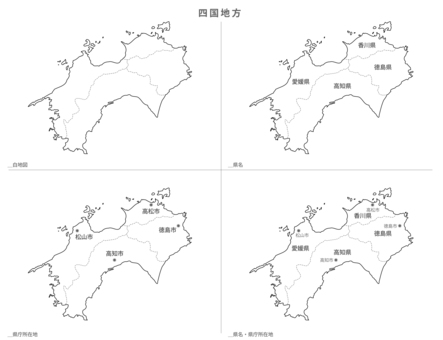
Title: Takamatsu city area (with Yashima fog)
Image ID: 25648362
Downloads: 0
Model release: N/A
Property release: N/A
Categories:
المباني-الهندسة-المعمارية / Takamatsu city area (with Yashima fog)
طبيعة-المناظر-الطبيعية / Takamatsu city area (with Yashima fog)
طبيعة-المناظر-الطبيعية / Takamatsu city area (with Yashima fog)
, JPG")
0
Share
Like
Antivirus
S
640 x 480 px
FREE
M
1920 x 1440 px
FREE
L
4032 x 3024 px
FREE
Upgrade to download up to 10 images at a time.
Standard license
This Takamatsu city area (with Yashima fog) photo can be used for personal projects. It can also be used for commercial projects in some cases. Read more
Image information
المنشئ:スターゲイザー☆2501
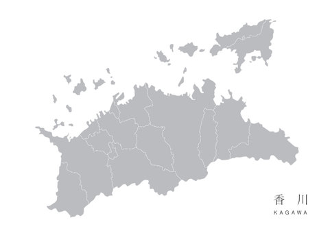
Title: Takamatsu city area (with Yashima fog)
Image ID: 25648362
Downloads: 0
Model release: N/A
Property release: N/A
Categories:
المباني-الهندسة-المعمارية / Takamatsu city area (with Yashima fog)
طبيعة-المناظر-الطبيعية / Takamatsu city area (with Yashima fog)
طبيعة-المناظر-الطبيعية / Takamatsu city area (with Yashima fog)
Similar free stock photos
View all
Similar free illustrations
View all


Similar free illustrations
View all Comments
Login or Sign Up to leave a comment